
The Brecks Fen Edge and Rivers Landscape Partnership Scheme. – by Nicole Hudson
The landscapes of Norfolk are incredibly diverse; from the panoramic beaches of the north coast to the labyrinth of reed-lined waterways of the Broads, the bustling hubbub of Norwich city centre, to the expansive flat marshes of the east towards Great Yarmouth. However, it is the west of the county that draws the focus of this blog, as well as that of the region’s leading conservation, wildlife, and heritage organisations.
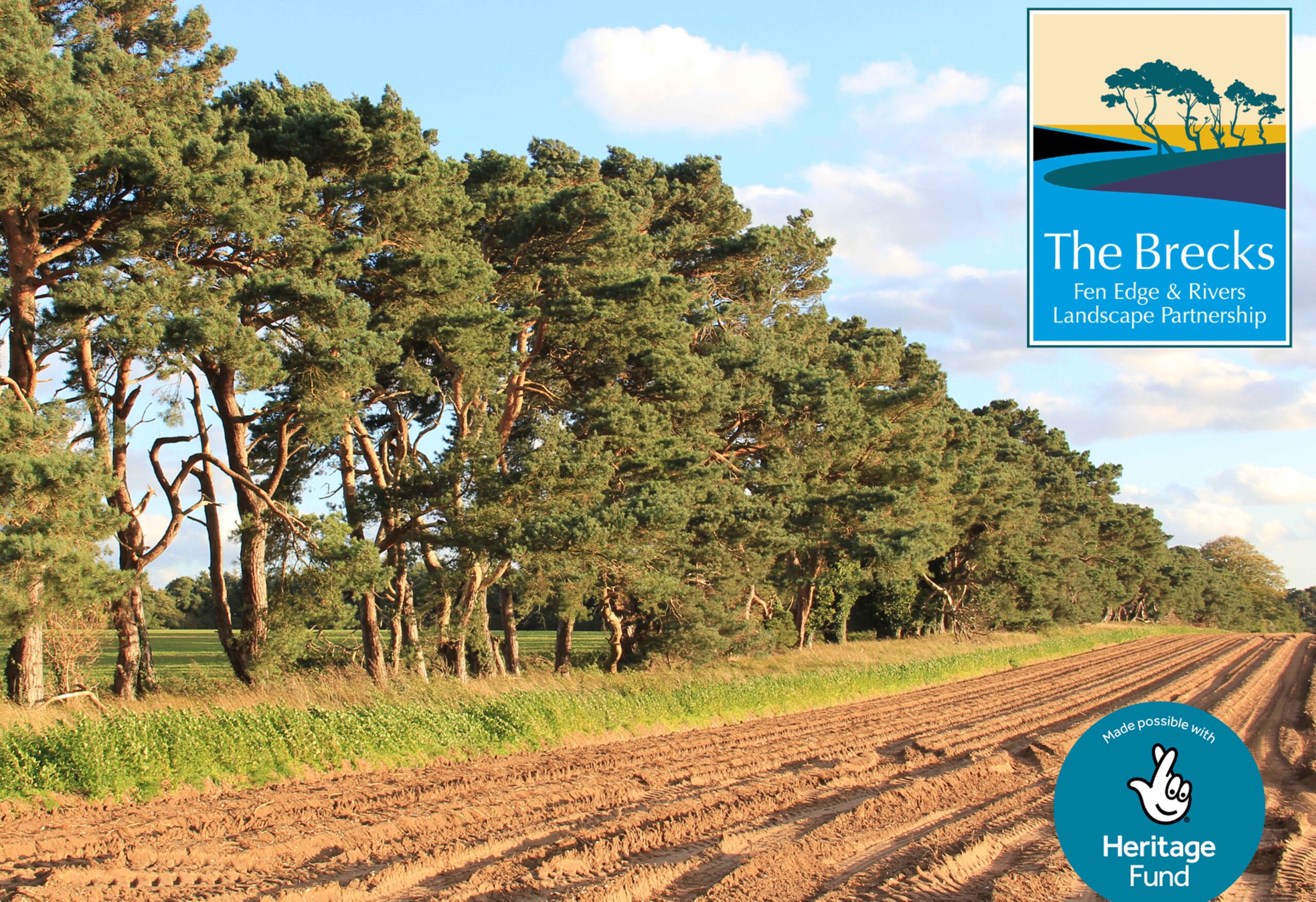
The Brecks is a landscape that covers an area of 393 sq. miles/1019 sq. kilometres, spanning over west Norfolk and northwest Suffolk. Iconic for its heathlands, forests, and lines of crooked pine trees, for many, the Brecks may only be familiar as the view from a vehicle when crossing the county. However, those who have explored the Brecks will attest to the beauty and intrigue of this diverse landscape.
What is the Brecks?
The name ‘Brecks’ originates from a 1926 publication of W.G. Clarke’s book In Breckland Wilds. ’Brecks’ was a term referring to temporary fields that were cultivated for a few years, before being allowed to revert to natural heathland. The Brecks itself comprises of low fertility sandy and chalky soils, and for centuries this was managed through shifting arable farming, sheep grazing and rabbit warrening. Described by an observer in the 1760s as ‘a mere African desert’, the Brecks was frequently subjected to sandstorms, including one which engulfed the village of Santon Downham in 1668. The iconic Brecks ‘pine lines’ that we see today silhouetted against the broad sky, are rows of Scots pine trees that were originally planted as hedges, aiming to act as windbreakers to prevent sandstorms.
In his 1850 novel, David Copperfield, Charles Dickens described the Brecks as ‘Barren’. However, this is not the case. The dryness of both the soil, and the semi-continental climate, in-fact result in grasslands and heathlands that are abundant with a diverse range of plants, animals, and insects. Many of these are rare and endangered species, that thrive in this unique habitat.
Today much of the Brecks is home to forests, after significant areas were acquired by the Forestry Commission in the 1920s and 30s and planted with commercially managed conifers. Despite these changes, significant expanses of Brecks heath survive, and the area remains a hotspot for biodiversity.
Water in a dry landscape
The dry landscape of the Brecks is intersected by five rivers, in addition to many streams and tributaries. For centuries, human settlements have formed along these rivers, which have served as essential watercourses for transport, drinking water, food sources, irrigation, and industrial power. The archaeological site of West Stow Anglo-Saxon village sits adjacent to the river Lark, while the prominent position of the town of Thetford on the river Little Ouse and river Thet, attracted Viking occupation in the late 9th century.
The rivers are also thriving freshwater habitats and are a conduit for biodiversity. The Brecks is home to chalk rivers, which are rivers that emerge from chalk aquifer. Chalk rivers are very pure and rich in minerals, allowing diverse aquatic plants, invertebrates, and fish to thrive. Only 200 chalk rivers are known globally, of which 85% are found in the UK.
In addition to the rivers, the north of the Brecks is home to the UK’s largest density of ‘pingo ponds’. Also known as Kettle Lakes, these incredibly rare ponds were created around 12,000 years ago at the end of the last ice age. ‘Pingo’ is the Inuit word for hill. Pingo Ponds were formed as the result of ice mounds which collapsed to create pools. These ancient, unchanged ponds are fed by ground water, and create lush wetlands that are home to many rare and important species. Thompson Common, which is home to a large collection of pingos, is one of the UK’s most important sites for dragonflies and damselflies, as well as over 600 species of beetle.
The Freshwater Habitats Trust ranked the Brecks as an area of national significance alongside the New Forest and the Norfolk Broads for the importance of its freshwater wildlife.
Celebrating and conserving the Brecks
In 2020, a five-year project was launched to celebrate and conserve the unique landscapes of the Brecks. The Brecks Fen Edge and Rivers landscape partnership scheme (BFER) is supported by the National Lottery Heritage Fund, with thanks to players of the National Lottery.
As a landscape partnership scheme, BFER is a joined-up programme of projects working to engage people with the freshwater habitats of the Brecks. BFER consists of 24 projects, each of which is led in partnership with regional, national, and local organisations with an interest in the area. BFER encompasses history, ecology, art, and wellbeing: from river restoration to archaeology, oral history to restoring lost pingo ponds, community art workshops to outdoor swimming events. To find out more about BFER and its projects, visit: brecks.org
How can you get involved?
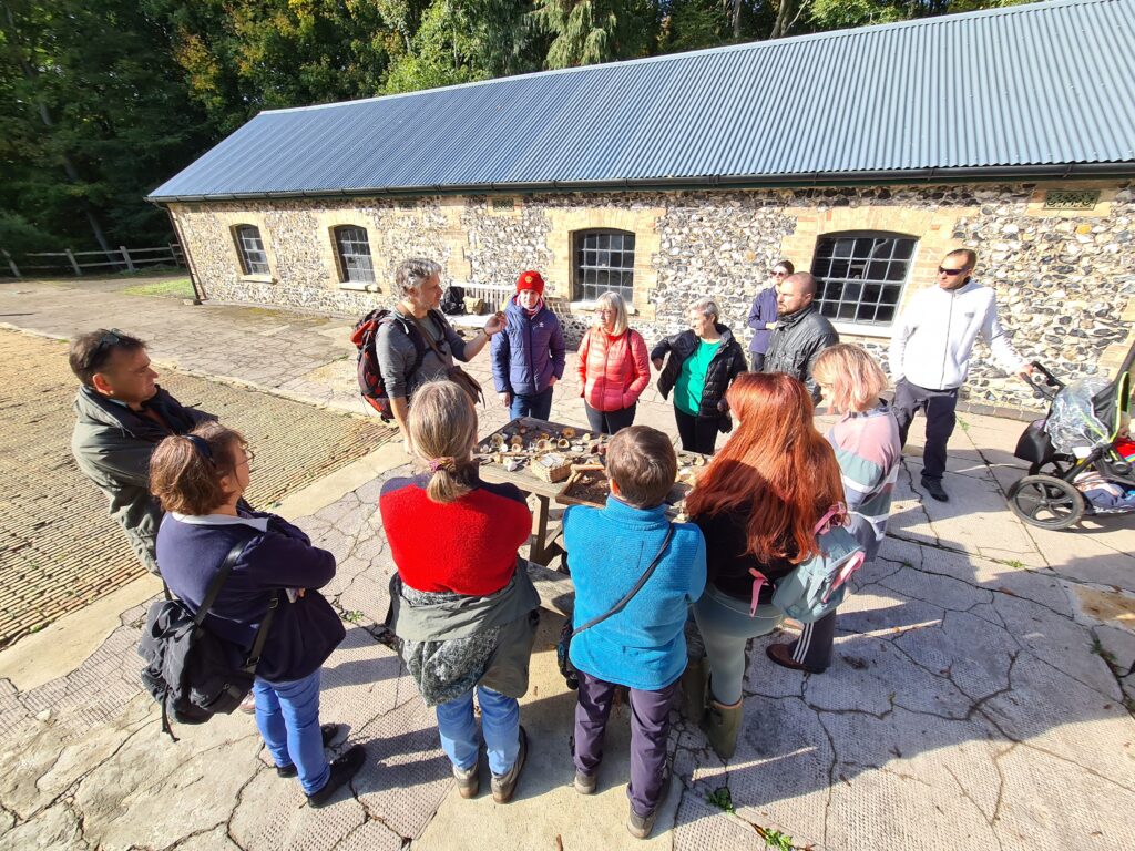
BFER hosts a year-round programme of free or low-cost public events and activities, which encourage outdoor opportunities for people to engage with Brecks landscapes. These include:
- Expert led talks, workshops, and guided walks.
- Health and wellbeing activities such as community running events, outdoor yoga, forest bathing, canoeing, and introductions to outdoor swimming.
- Creative artist led workshops.
To stay tuned to our latest events and activities, visit: brecks.org/events
Or follow BFER on Twitter, Facebook, and Instagram: @TheBrecksLP
Volunteer with BFER
BFER is looking for volunteers to assist with the project: from volunteers to support at our exciting events, ‘Brecks reporters’ to write short blogs about what makes this landscape so special, and Digital Content Creators (to help us to make and edit videos and create social media content). If you would like to find out more, please say hello at: bfer.admin@suffolk.gov.uk
Further opportunities:
Contact BFER for more information: bfer.admin@suffolk.gov.uk
BFER works with Brecks based schools to deliver education packs, projects, and work placements, as well as providing funding opportunities for bespoke projects that link to the environment and heritage of the Brecks.
Community Grant Fund
BFER has a community grants fund available to support projects that will engage Brecks communities, and enhance, restore, and celebrate the landscapes, heritage, and wellbeing opportunities of the Brecks. If you are part of a community, organisation, or school in the Brecks with a project that needs funding support, please get in touch with BFER.